Nanoseconds Aloft: Why Sensor Timestamp Architecture Is the Hidden Backbone of GPS-Denied Drone Navigation
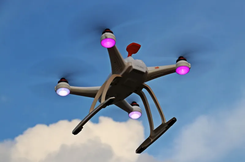
For most of the commercial drone industry's short history, GPS has functioned as an invisible crutch. Operators and engineers alike have grown accustomed to satellite-derived position updates arriving reliably every second or so, continuously correcting whatever drift accumulates between fixes. That comfort is disappearing. From urban canyon environments where signal multipath renders GNSS unreliable, to military theaters where jamming and spoofing are deliberate tools of adversarial strategy, the assumption that GPS will be available is no longer one engineers can afford to make.
What has emerged in its place is a renewed engineering focus on dead reckoning—the ancient navigational discipline of estimating current position from a known starting point, using measured velocity, heading, and elapsed time. In the digital implementation aboard modern autonomous drones, dead reckoning is no longer a single-sensor exercise. It is a multi-modal fusion problem, combining inertial measurement units (IMUs), barometric pressure sensors, magnetometers, and optical flow cameras into a coherent positional estimate. And at the center of that fusion problem, quietly determining whether the whole system holds together or catastrophically diverges, is the question of timing.
The Compounding Arithmetic of Drift
Dead reckoning is an inherently accumulative process. Every estimate of position depends on the accuracy of the previous estimate, compounded by the accuracy of the velocity and heading measurements integrated over a time step. Error does not stay constant—it grows. A small systematic bias in an IMU's accelerometer output, integrated twice over several minutes of flight, produces position errors that scale with the square of elapsed time. This is the fundamental vulnerability that GPS corrections were masking.
Sensor fusion addresses this by cross-referencing multiple independent data streams, each with different error characteristics. An IMU drifts over time but responds instantly to motion. An optical flow sensor provides velocity estimates relative to the ground but degrades over featureless terrain. A barometer constrains altitude drift but is susceptible to pressure fluctuations from rotor wash. Together, they provide complementary constraints that a well-designed filter—typically an Extended Kalman Filter or one of its unscented or particle-based variants—can exploit to bound the overall position error.
But this complementarity only holds if the data streams are temporally coherent. If the IMU measurement tagged at time T is being fused with an optical flow measurement that was actually captured at time T + 400 µs, the filter is operating on a physically inconsistent state. It is attempting to reconcile measurements of the world taken at different moments as if they described the same instant. The resulting cross-correlations are wrong, the covariance estimates are wrong, and the position solution degrades in ways that are difficult to diagnose precisely because the filter continues to produce a number—just not a correct one.
Why Microseconds Matter at Drone Velocities
The sensitivity of position error to timestamp misalignment scales directly with platform dynamics. A drone cruising at 15 meters per second—a modest speed for many commercial and military applications—travels 15 micrometers in one microsecond. That sounds inconsequential until one considers that sensor fusion pipelines operating at 400 Hz are integrating IMU data over 2.5-millisecond windows, and that a 500-microsecond timestamp error between the IMU and optical flow sensor introduces a systematic velocity error of 7.5 millimeters per integration step. At 400 Hz, that error is applied 400 times per second. Over a three-minute GPS-denied flight segment, the cumulative positional bias can reach tens of meters—sufficient to turn a precision autonomous mission into a navigational failure.
High-dynamic maneuvers compound the problem severely. During aggressive attitude changes, angular rates can exceed 300 degrees per second. A 100-microsecond misalignment between the IMU and the magnetometer under those conditions introduces attitude errors approaching 0.03 degrees—small in isolation, but systematically biasing every subsequent dead reckoning step.
FPGA-Based Timestamping Pipelines: The Hardware Case
The engineering response to this timing sensitivity has increasingly pointed toward dedicated hardware timestamping rather than reliance on software-layer synchronization. Processor-based flight computers, regardless of their real-time operating system configuration, introduce non-deterministic interrupt latencies that can vary by hundreds of microseconds under computational load. For a navigation pipeline demanding nanosecond-level timestamp consistency, this is structurally incompatible.
FPGA-based sensor hub architectures address this by moving the timestamp capture function into programmable logic, where every sensor trigger and data-ready signal can be latched against a common free-running hardware counter with sub-nanosecond resolution. The FPGA does not process the navigation filter—that remains the domain of the flight computer's processor—but it provides a single authoritative time reference against which every sensor sample is tagged before being passed upstream. The result is a timestamped data stream in which the temporal relationships between sensor observations are known to nanosecond precision, regardless of whatever scheduling jitter occurs in the software layers above.
Several defense-adjacent drone programs in the United States have adopted this architecture, and the approach is beginning to influence commercial platforms where extended GPS-denied operation is a stated requirement. The additional cost and design complexity of an FPGA sensor hub is non-trivial, but for applications where positional integrity over a ten-minute GPS-denied segment is mission-critical, the arithmetic of drift accumulation makes the investment difficult to argue against.
The Standards Landscape: An Unresolved Contest
Beyond individual platform design, the drone industry faces a broader question about how sensor synchronization standards should be formalized. Two competing philosophies are currently in tension. The first, championed by segments of the defense and research communities, advocates for hardware-level time distribution—essentially a drone-adapted implementation of IEEE 1588 Precision Time Protocol, in which a grandmaster clock distributes a common time reference to all sensor nodes over a deterministic bus. The second approach, more common in commercial autopilot ecosystems, relies on software-layer timestamping with post-hoc correction algorithms that attempt to estimate and compensate for known latency offsets.
Neither approach has achieved clear industry dominance, and the MAVLink protocol—the de facto messaging standard for open-source drone platforms including ArduPilot and PX4—currently lacks a standardized mechanism for hardware-level timestamp propagation across heterogeneous sensor buses. This gap is not merely an academic concern. It means that two drones built on ostensibly identical software stacks may exhibit significantly different dead reckoning performance depending on the timing characteristics of their specific hardware implementations—a variability that complicates both testing and certification.
The Navigation Floor
Dead reckoning has never been about eliminating drift. Physics does not permit that. It is about managing drift precisely enough that the accumulated error over a defined mission segment remains within operationally acceptable bounds. What the time-domain architecture of a sensor fusion pipeline determines is the location of that floor—the minimum achievable drift rate for a given sensor suite.
Engineers who have spent years optimizing IMU grades, filter architectures, and optical flow algorithms sometimes discover that their system's actual performance is limited not by any of those components individually, but by the temporal coherence of the data those components are generating. The nanoseconds matter. The timestamping discipline matters. And as autonomous drones push further into environments where GPS cannot be trusted, the engineers who understand that will be the ones whose platforms hold position when the satellites go silent.